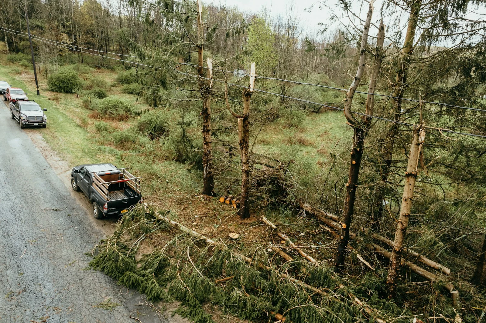
SYRACUSE, N.Y., A line of severe thunderstorms tore across Central New York Monday evening, knocking down utility poles, triggering fire alarms across the metro area, and sending emergency crews scrambling from Liverpool to DeWitt. The storms, which rolled through between roughly 6 and 9 p.m. brought damaging winds, heavy rain, and frequent lightning to Onondaga, Madison, Oneida, and surrounding counties.
The worst of it is over. But the cleanup is just getting started.
Storm Aftermath & Damage Reports
Emergency radio traffic and dispatch records from Monday night paint a picture of a region absorbing a direct hit:
This story came from public records we pulled ourselves
Get the next one, plus overnight incidents, in your inbox at 6 AM. Free, no spam.
- Utility pole fire, Route 31 at Shackelton Point Road: Bridgeport Fire Department responded to a utility pole fire on Petrie Road near Route 31 and Shackelton Point Road shortly after 7 p.m. Crews worked to secure the scene as downed lines blocked the roadway.
- Hazardous road conditions, Route 80 at Deruyter Road: New York State Police flagged a hazardous condition near the intersection of Deruyter Road and Route 80. Drivers in Madison County should use caution overnight.
- Fire alarms across the metro: Syracuse Fire responded to multiple automatic fire alarms triggered during the storm, including calls on Bishop Avenue near West Colvin Street and at a commercial property on North Townsend Street near Burnet Avenue. DeWitt Fire handled an alarm on Collamer Road at the Bull & Bear Roadhouse near Northern Boulevard.
- Multi-unit fire response in Cicero: Three Cicero fire units, including Engine 1, rolled to an incident during the height of the storm around 8:38 p.m.
- Liverpool fire response: Liverpool crews were dispatched during the storm window as well, with Squad 2 responding to a call in the village.
- Motor vehicle crashes: Syracuse Fire and police responded to a collision with injuries near South Salina Street and East Newell Street. Cicero Police handled damage-only crashes at the Kwik Fill on Route 31 and near the Route 481 interchange at Panera Bread on East Circle Drive. A hit-and-run investigation was opened in Van Buren near the Tops on Downer Street Road.
- Industrial fire, Midland Avenue: Syracuse Fire responded to a commercial fire call at the IBB Mini Mart on Midland Avenue between West Beard Avenue and West Colvin Street.
Power Outage Information
If you’ve lost power, here’s who to call:
- National Grid: 1-800-867-5222 or nationalgridus.com/outage-central
- NYSEG: 1-800-572-1131 or nyseg.com/outages
Restoration times will depend on the scope of the damage. National Grid typically prioritizes downed lines and circuits serving the most customers first. If a tree took down your service line, expect a longer wait, those are handled individually after main feeder lines are restored.
What To Do Now
By The Numbers
What’s Next, Overnight Forecast
The front that drove Monday’s storms is now well east of Central New York. Skies will gradually clear overnight, with temperatures dropping into the mid-40s by dawn. Patchy fog is possible in river valleys and low-lying areas, particularly along Onondaga Creek and the Seneca River corridor.
Tuesday looks significantly better, partly sunny with highs near 58. Winds shift to the northwest at 8-12 mph, and there’s no rain in the forecast until at least Thursday.
The bigger concern overnight is what the wind left behind. Branches, debris, and potentially live wires could be scattered across roads that were clear this morning. Give yourself extra time on the Tuesday commute, especially on secondary roads through wooded areas.
Stay With CNY Signal
We tracked this system from watch to aftermath. If additional damage reports come in overnight, we’ll update this story.
Bookmark cnysignal.com/weather/ for the full forecast and cnysignal.com/alerts/ for live alerts.
Updated 12:45 a.m. EDT, Tuesday, April 1, 2026, Storm has passed. Article rewritten to reflect aftermath and damage reports.