Six Green Spaces Around Syracuse That Deserve a Spot on Your Weekend List
Central New York’s best-kept outdoor secrets include a lake whose deep waters haven’t stirred in millennia, the only navigable Erie Canal aqueduct in the state, and a waterfall older than memory.
By CNY Signal · March 30, 2026
There’s a persistent myth about Syracuse: that the city’s best season is the two weeks in June between mud and mosquitoes. It gets a laugh at Dinosaur Bar-B-Que. It collapses the moment you lace up trail shoes and actually go looking.
The greater Syracuse area sits on a geological inheritance most cities would kill for, glacial gorges, meromictic lakes so uncommon that roughly one in a thousand qualifies, and ribbon waterfalls that predate European settlement by millennia. Some of these places draw crowds. Most don’t. A few are so tucked away that lifelong Onondaga County residents drive past them for decades without knowing they exist.
This story came from public records we pulled ourselves
Get the next one, plus overnight incidents, in your inbox at 6 AM. Free, no spam.
Here are six that earned a place on the list, not because they’re pretty, though they are, but because each tells a surprising story about where we live.
Clark Reservation: A 10,000-Year-Old Waterfall That Stopped Falling
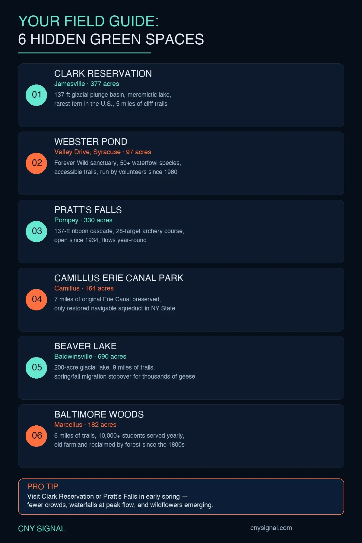
Clark Reservation State Park, tucked into the town of DeWitt just south of the city, is one of the strangest geological sites in the Northeast. Its central feature is Glacier Lake, a 6.2-acre pool sitting at the bottom of a plunge basin carved by a waterfall that once exceeded 180 feet, taller than Niagara Falls. Around 10,000 years ago, as the last ice sheet retreated, meltwater torrents gouged out the gorge that visitors now peer into from limestone cliffs that still rise 180 feet above the water.
The waterfall is long gone. The lake it left behind is not ordinary. Glacier Lake is meromictic, meaning its deep waters and surface waters do not mix seasonally the way most lakes do. In the United States, there are fewer than 20 lakes with this characteristic. Two of the others happen to be just a few miles away at Green Lakes State Park, making this corner of Onondaga County one of the most unusual freshwater environments in the country.
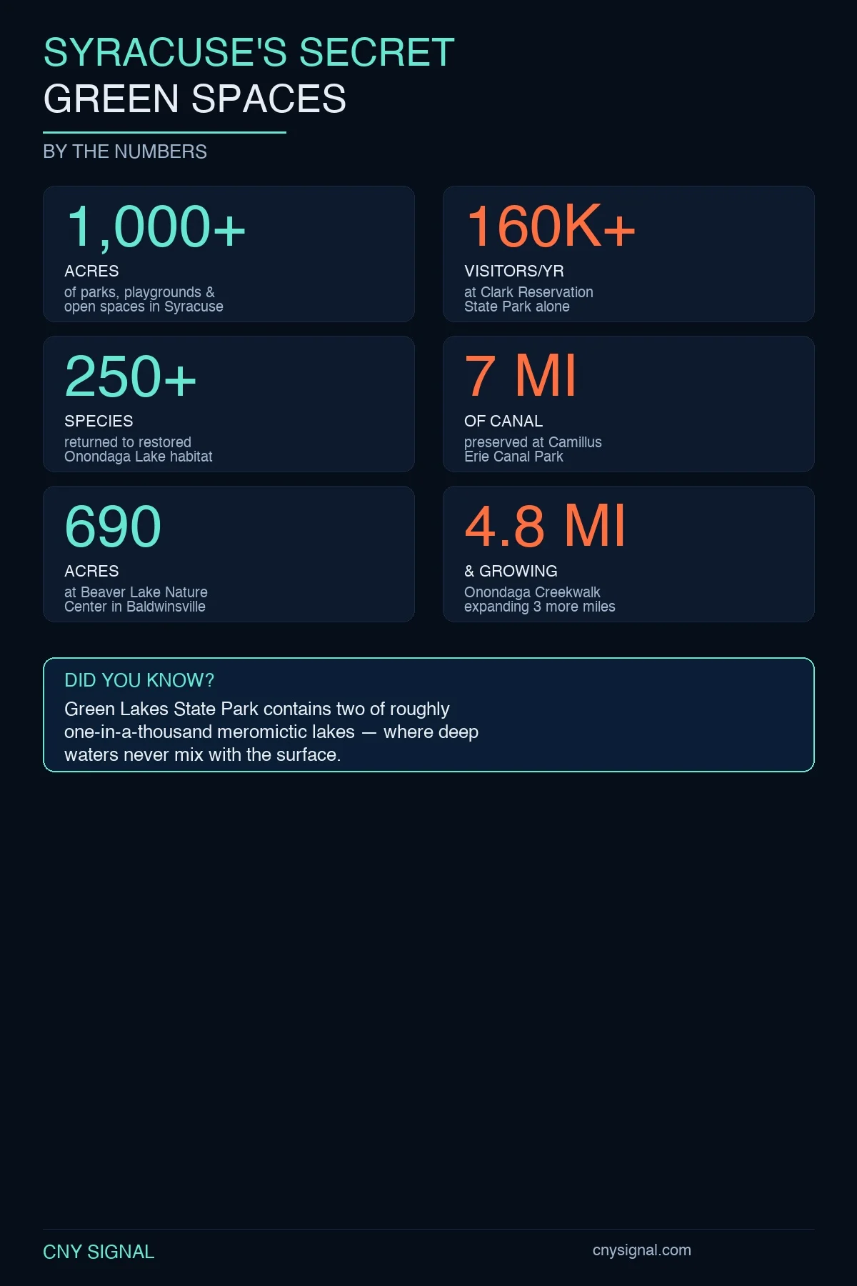
By the numbers: 377 acres, 160,000+ visitors per year, nearly 5 miles of trails, and one of the principal U.S. populations of the endangered American hart’s-tongue fern, a species so rare it was federally listed in 1989. Ninety-four percent of all hart’s-tongue ferns in New York grow within Clark Reservation and nearby Chittenango Falls State Park.
The fern connection is part of the park’s origin story. In the late 1800s, during the Victorian craze known as “pteridomania”, literally, fern madness, botanists flocked to the gorge after hart’s-tongue specimens were first documented here in 1866. Some historians believe the fern, more than the scenery, is the reason Clark Reservation became a state park in 1926. The land was donated by Mary Clark Thompson of New York City as a memorial to her father, Myron Clark, who served as governor of New York from 1855 to 1857.
The Cliff Trail is the marquee hike: a ledge walk 175 feet above the lake that, on a clear morning, feels like standing on the rim of a small, improbable canyon. The Friends of Clark Reservation, an all-volunteer nonprofit, operates a Nature Center from Memorial Day through Labor Day with exhibits on the park’s geology and natural history.
Webster Pond: A Revolutionary War Veteran’s Land, Saved From a Landfill
Drive south on Valley Drive past the strip malls and you’ll reach a 97-acre wildlife sanctuary that, by all rights, should not exist. Webster Pond sits on land originally granted by the New York state legislature in 1795 to Ephraim Webster, a Revolutionary War veteran. The tract changed hands over the centuries, Herbert and Elaine Rand purchased the 97 acres in 1925, but by the mid-twentieth century, the city was weighing whether to turn the whole parcel into a landfill.
That didn’t happen, because the Anglers Association of Onondaga, a conservation group that has operated continuously since 1890, when local sportsmen organized against the pollution of Oneida Lake, intervened. In 1960, the association signed a long-term management agreement with the City of Syracuse. Sixty-five years later, they still open the gates every morning.
Today Webster Pond is a designated “Forever Wild” Conservation Area, home to more than 50 species of domestic waterfowl and a draw for bald eagles that roost in the surrounding trees. The trails are fully accessible, and the site has become an important destination for residents with intellectual and developmental disabilities and their aides.
The heart of the operation is volunteer. Chad Norton, president of the Friends of Wildlife, first visited at age seven, dragged there by his parents for an Elvis impersonator concert, and offered to volunteer on the spot. Norton, who uses a wheelchair due to cerebral palsy, has been caring for the pond since 1994. The whole place runs on donations, corn sales, and whatever grants the association can land.
Pratt’s Falls: A 137-Foot Cascade That Never Runs Dry
Pratt’s Falls County Park, 20 minutes southeast of downtown in the town of Pompey, centers on a 137-foot ribbon cascade that has been drawing visitors since the park opened on July 3, 1934. But the site’s history stretches back to 1796, when Manoah Pratt, Sr. and Abraham Smith, both Connecticut transplants, built one of the first sawmills in Onondaga County at the base of the gorge. By 1798, they’d converted it to a flour mill.
The falls themselves are a product of glacial carving through limestone. Water bounces from one jagged ledge to the next, throwing mist that catches light on sunny mornings. A small dam-formed pond above the falls is the reason Pratt’s keeps flowing when other area waterfalls go dry in summer, the impoundment acts as a natural regulator.
Beyond the falls: The 330-acre park holds over 5 miles of trails, two sheltered picnic areas seating up to 100 people each, and, this surprises most visitors, a 28-target archery course winding through a full mile of woods. Camp Brockway, a lodge built in 1937, can host 180 seated guests or 400 standing.
The North Rim and West Branch trails form a 3.5-mile loop that takes hikers near the gorge rim, through hardwood forest, and across open meadows. It’s moderate terrain with some elevation changes, the kind of half-day outing that rewards a packed lunch and a thermos of coffee.
Camillus Erie Canal Park: The Only Navigable Aqueduct Left in New York
When the Erie Canal was completed in 1825, it was the engineering marvel of the young republic, the first navigable waterway between the Atlantic and the Great Lakes. Syracuse was a canal city before it was anything else. But as rail and road replaced water, most of the original infrastructure was filled in or paved over.
Not in Camillus. The 164-acre Camillus Erie Canal Park preserves seven continuous miles of the original canal corridor, making it one of the longest intact segments anywhere on the route. The park exists because volunteers and the Town of Camillus fought to save the canal from being filled in starting in 1972.
The crown jewel is the Nine Mile Creek Aqueduct, listed on the National Register of Historic Places since 1975. Of the 32 aqueducts built during the canal’s first enlargement in the 1840s, it is the only one that has been restored to navigable condition. After a $2 million restoration completed in August 2009, a canal boat crossed the aqueduct for the first time in 89 years. Public boat rides are still offered on Wednesdays and Sundays at 1 and 2 p.m.
The trail system follows the original towpath, the path mules once walked while pulling barges, through woodlands and farmland. The South Towpath Trail runs 3.25 miles from Newport Road to the aqueduct. A separate half-mile Clinton’s Ditch Trail traces the original 1825 canal, even narrower than the enlargement that replaced it. Sims’ Store, a replica canal-era shop, operates as a museum with early photographs, maps, and models of the locks.
Beaver Lake and Baltimore Woods: The Quiet Preserves
Twenty minutes northwest of the city, Beaver Lake Nature Center in Baldwinsville occupies 690 acres anchored by a 200-acre glacial lake. Nine miles of maintained trails thread through bog, meadow, wetland, climax forest, and conifer stands, an unusual diversity of habitats for a single park. During spring and fall migration, thousands of Canada geese and other waterfowl use the lake as a staging ground, and on peak days the sky above the preserve is loud with it.
Beaver Lake is part of the Onondaga County Parks system and operates year-round, from 7:30 a.m. until dusk, with a $5-per-vehicle admission. Canoeing, kayaking, snowshoeing, and cross-country skiing rotate through the calendar. Staff naturalists run programs that include guided hikes, summer camps, and natural history seminars. No dogs, bicycles, or private fishing, the restrictions exist specifically to keep the environment undisturbed enough that the wildlife stays.
Twenty minutes in the opposite direction, Baltimore Woods Nature Center in Marcellus has been part of the CNY community since 1966. Its 182 acres, once working farmland, now reclaimed by forest, hold six miles of trails through a wooded stream valley carved out of glacial debris. What sets it apart is scale of impact: the Nature in the City program reaches all 19 Syracuse City elementary schools, putting hands-on science lessons in front of more than 10,000 students a year. Over 20,000 people visit annually.
The Bigger Picture: A Region Reinvesting in Its Land
These six sites don’t exist in isolation. They’re part of a broader pattern of investment and restoration across Onondaga County that has accelerated in recent years.
The Onondaga Creekwalk, currently 4.8 miles of accessible pathway connecting the Southside through Armory Square to Onondaga Lake, is in the middle of a Phase 3 expansion that will add three miles of trail south to Dorwin Avenue. The projected cost exceeds $2 million, and public input sessions held in May 2025 drew residents to map preliminary route alternatives.
At Onondaga Lake, once one of the most polluted bodies of water in the country, more than 250 species have returned to restored habitat following Honeywell’s multibillion-dollar cleanup. In 2025, the state took ownership of the Onondaga Lake Visitor Center and more than 1,000 acres of ancestral Tully Valley land were returned to the Onondaga Nation. Swimming remains restricted, but the Loop-the-Lake trail has made the shoreline publicly accessible in ways unthinkable 20 years ago. Meanwhile, the Carrier Park Superfield of Dreams, a $1 million inclusive sports complex, is set to open this April.
250+ species have returned to Onondaga Lake’s restored habitat. More than 90 acres of wetlands, 18 acres of in-lake habitat, and over 150,000 native plants now line the shoreline and tributaries.
The Bottom Line
Syracuse has a reputation problem outdoors. The national conversation fixates on snowfall totals and gray skies; locals default to Green Lakes on the first warm Saturday. Fine, but it’s not the whole story.
Within a 25-minute drive of Clinton Square, you can stand on a cliff above a lake whose bottom waters haven’t mixed with the surface in thousands of years. You can walk the same towpath that mules dragged canal barges along in the 1840s. You can watch bald eagles settle into the trees above a pond that was almost turned into a landfill. You can hike past the endangered fern that may have saved an entire state park from development.
These aren’t weekend-trip destinations. They’re Tuesday-after-work places. Saturday-morning-before-brunch places. The kind of green space that makes living here, actually living here, not just commuting through, worth it. They’ve been here for 10,000 years. They can wait for you to show up.
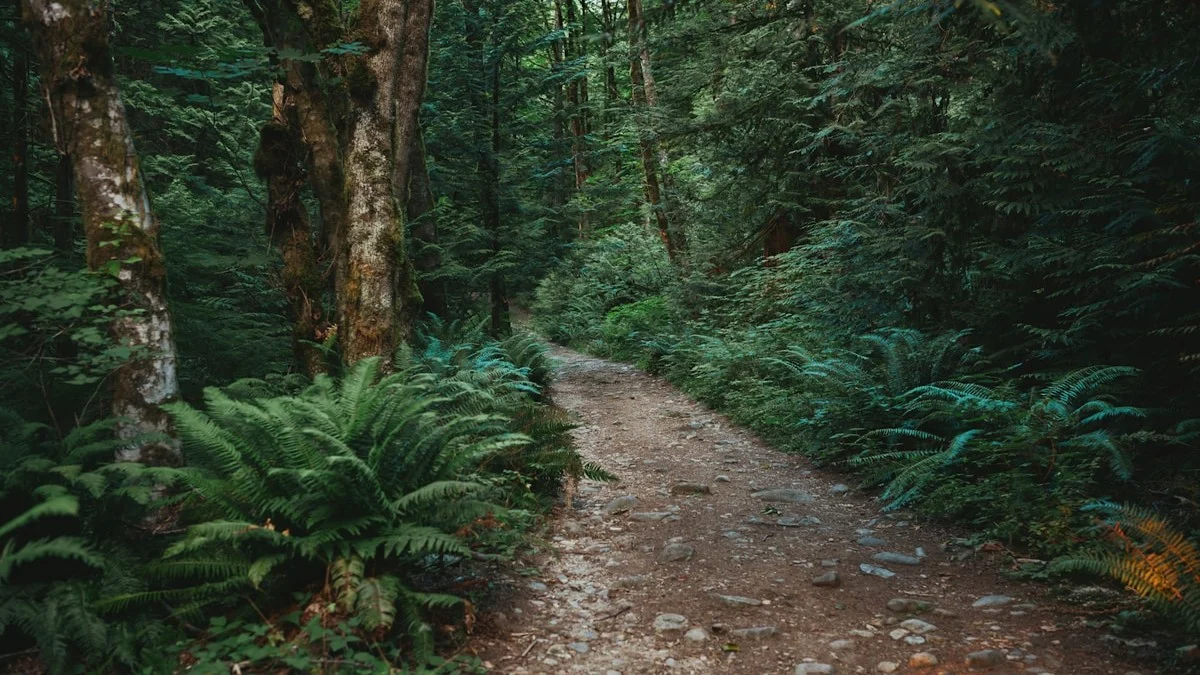
Photo credit: Albert Stoynov / Unsplash
By the Numbers