Every waterway in Onondaga County is closed under an emergency executive order Ryan McMahon signed on April 8. The order runs through at least April 13 and can extend to May 8.
That’s the news every outlet reported. Here’s the question none of them asked: who decides how high Oneida Lake gets?
The answer is the New York State Canal Corporation, a subsidiary of the New York Power Authority. The Canal Corporation operates the outlet structures that control how water leaves Oneida Lake via the Oneida River, which feeds into the Erie Canal system. Water levels on the lake are managed. they’re not purely natural.
The Caughdenoy Dam. 15 feet high, 550 feet long, completed in 1909. is the sole outlet control structure. It holds back 255,360 acre-feet of water from a 1,382-square-mile drainage area. Its hazard rating from the NYS DEC is “Significant.” It was last inspected on August 13, 2009. almost 17 years ago. There is no emergency action plan on file.
A county spokesperson confirmed this is the first countywide waterway closure in approximately a decade.
Two Simultaneous Emergencies
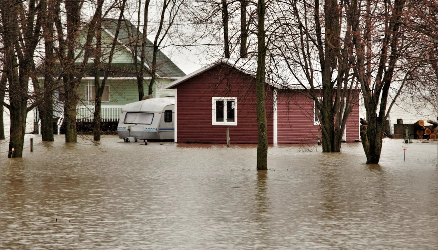
Two separate emergency declarations are active simultaneously: McMahon’s countywide waterway closure and the Town of Cicero’s state of emergency on Beach Road, where Oneida Lake has swallowed portions of the road.
Cicero Town Supervisor Rob Santucci banned all non-essential traffic on Beach Road through at least April 15. The Cicero Police Department is issuing citations to anyone without a Beach Road address. Vehicles traveling through the flood zone were creating wakes that eroded properties and damaged homes. so speed limits failed, and a full traffic ban followed.
Beach Road has flooded before. In August 2021, resident Bob DiFlorio described ankle-deep water that came within one inch of entering his home, requiring three pumps. In January 2018, ice jam flooding at Fish Creek required approximately a dozen fire departments for rescues.
The Numbers Behind the Water
As of April 11, Oneida Lake stands at 369.43 feet MSL. 0.43 feet above full pool elevation. The Canal Corporation’s seasonal target for April 1 is 370.30-371.00 feet.
March 2026 precipitation hit 5.58 inches. 2.37 inches above normal, nearly double the typical March rainfall. NYS precipitation has been increasing at +0.47 inches per decade since 1901, a trend statistically significant at 99% confidence.
The county identified three hazards: dangerous unpredictable currents, hidden submerged debris, and reduced bridge clearance. Beyond boating, elevated water is eroding docks, undermining retaining walls, and encroaching on residential properties.
Sandbag stations at South Bay Fire Department and Muskrat Bay Fire Department have been restocked with several thousand sandbags. Residents only.
EMERGENCY ORDER. BY THE NUMBERS
THREE HAZARDS DRIVING THE CLOSURE
WHO CONTROLS THE WATER?
The chain of command for Oneida Lake water levels
What to Know
- Emergency order signed April 8. all waterways closed through at least May 8
- First countywide waterway closure in approximately a decade
- Caughdenoy Dam: last inspected 2009, no emergency action plan on file
- Canal Corporation controls Oneida Lake levels via Oneida River outlet
- Cicero state of emergency: Beach Road closed to non-residents, police issuing citations
- March 2026 precipitation nearly double normal (5.58 inches)
- NYS precipitation trend: +0.47 inches per decade since 1901
- Sandbag stations at South Bay FD and Muskrat Bay FD. residents only
Photo: Pexels. Sources: CNY Central, Spectrum News, WAER, LocalSYR, NY Sea Grant, USLakes Dam Database, CNYWeather.com, NOAA.