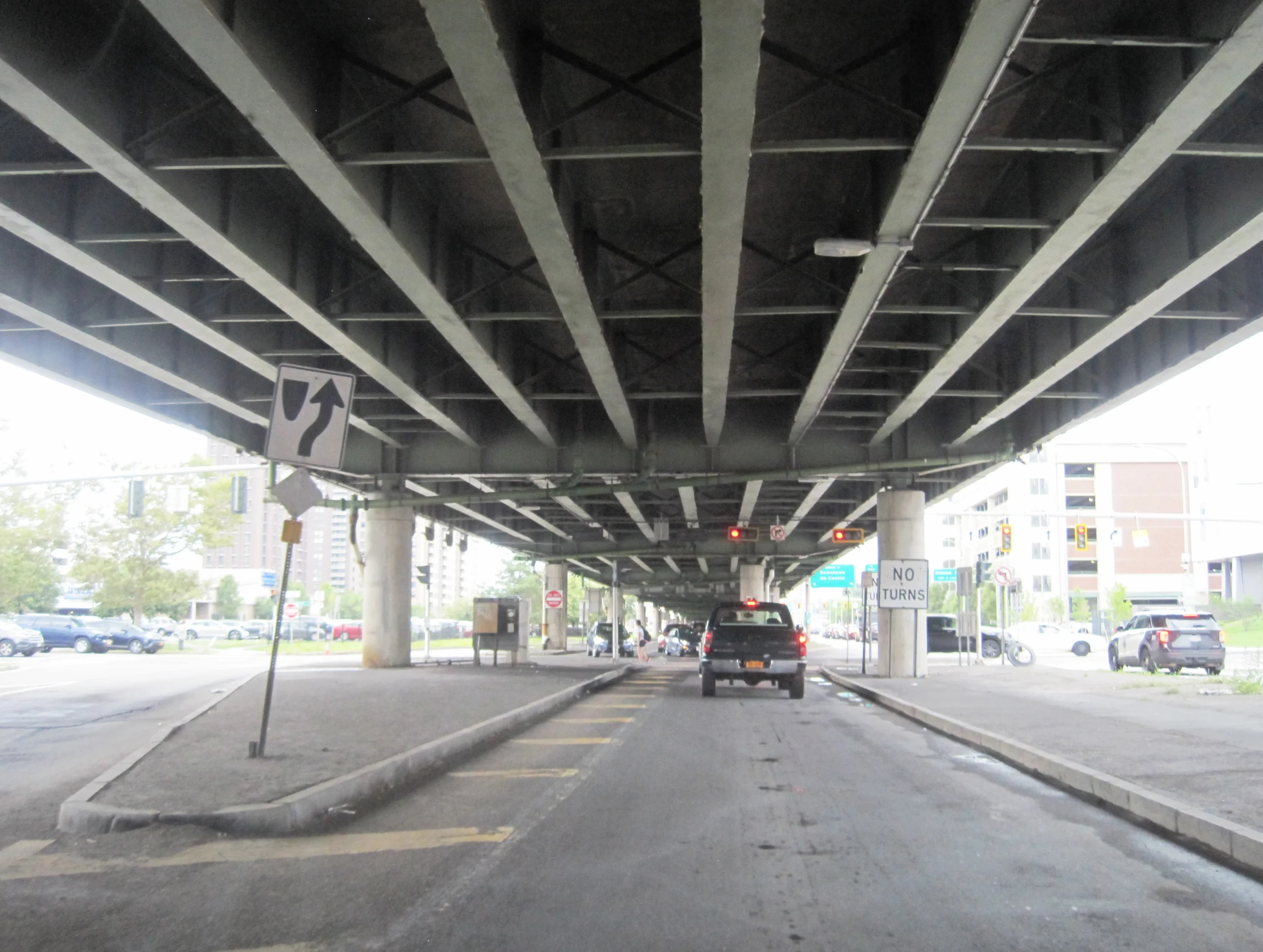
The 1.4-mile elevated viaduct that has carried Interstate 81 over downtown Syracuse since 1959 is being torn down. In its place, the New York State Department of Transportation is building a city street called Business Loop 81 along the old Almond Street corridor, while the through-traffic load gets shifted onto a redesignated I-481 ring around the city’s east side. The total project cost is estimated between $1.9 billion and $2.2 billion. The contracts are signed. The first demolition phases are underway. By the time the project is finished, Syracuse will be one of the only American cities to have removed an urban freeway through its center and replaced it with a surface boulevard.
Here is what is verified, what is funded, and what changes between now and 2027 for drivers who use I-81 through Onondaga County every day.
The decision: a 65-year-old structure at the end of its life
The downtown viaduct opened on August 14, 1957 as part of the Penn-Can Highway, the original New York name for what became I-81. The structure carries roughly 90,000 vehicles per day at its busiest point near the Adams Street and Harrison Street interchange, the exit that serves the Oncenter convention complex and Syracuse University. The viaduct was designed for a 50-year service life. As of 2024 it had been in service 67 years, with both the deck and the supporting columns rated as structurally deficient by federal Bridge Condition Index criteria.
Know before your neighbors do
The Morning Signal hits your inbox at 6 AM with everything that happened overnight. Real incidents, real data, zero fluff.
NYSDOT studied three replacement options through most of the 2010s: a rebuilt elevated viaduct, a depressed tunnel beneath downtown, and a community grid alternative that would tear down the elevated road and route through-traffic around the city. In April 2019, NYSDOT formally selected the community grid alternative. The decision survived a 2022 lawsuit by a Town of Salina coalition that briefly halted demolition work. A judge issued a partial stay in November 2022, then the state was cleared to proceed in February 2023.
Project at a glance
| Item | Detail |
|---|---|
| Project length | About 1.4 miles of viaduct removed |
| Total cost (NYSDOT) | $1.9B to $2.2B |
| Replacement | Surface boulevard along Almond Street; through-traffic on redesignated I-481 |
| Daily traffic at viaduct | About 90,000 vehicles per day |
| Decision date | April 2019 (Record of Decision: 2022) |
| Original viaduct opened | 1959, as part of the Penn-Can Highway designation |
| Reroute corridor | I-481, a 17.6-mile beltway built in 1969 |
What gets demolished, what gets built
The community grid plan removes the elevated structure between roughly Van Buren Street on the south and Spencer Street on the north. The Adams Street and Harrison Street ramps, the busiest interchange on the viaduct, will be eliminated. In their place, NYSDOT is widening Almond Street into a six-lane urban boulevard with traffic signals, marked crosswalks, and a planted median.
The 17.6-mile I-481 beltway, which has carried the I-481 designation since it opened to traffic in 1969, will be redesignated as I-81 itself. The current spur from the existing I-81 north of downtown to the I-90 New York Thruway interchange near Mattydale will become I-81’s main alignment. Through-truck traffic and long-distance interstate traffic will be routed onto the new alignment. Local traffic and downtown destinations will use the boulevard.
Two interchanges, one at the north end of the I-81/I-481 split near North Syracuse and one at the south end near Jamesville, are being completely reconstructed to handle the higher movement volumes that will result when I-481 becomes the main route.
The schedule
NYSDOT broke the project into roughly a dozen contracts to allow simultaneous work along the corridor. The early-phase contracts cover the Interstate 481 widening and the two end-point interchange rebuilds, both of which need to be finished before the downtown viaduct can come down. Those contracts were awarded in 2022 and 2023 and are now in active construction. The viaduct demolition itself is structured to occur in phases starting in 2025 and continuing through 2026, with final paving and street-grid work planned for 2027.
NYSDOT has not committed to a single ribbon-cutting date for the project as a whole. The agency has said the first phase that opens new pavement to traffic, the southern I-81/I-481 interchange near Jamesville, is targeted for completion in 2026. Project managers have publicly cautioned that final completion dates depend on contractor performance, weather windows, and any further legal action.
Daily-driver impact during construction
| Affected area | Expected disruption |
|---|---|
| I-481, all sections | Periodic single-lane shifts, weekend closures of inside shoulder |
| I-81 viaduct northbound | Adams Street exit ramp closed (already in effect) |
| Almond Street | Lane reductions during boulevard widening |
| South Salina / South Townsend | Periodic local detours for utility relocation |
| I-690 east-west | Nighttime ramp closures during overhead bridge demolition |
Who is paying
The project is paid for through a combination of federal and state highway funds. NYSDOT has identified the federal Bipartisan Infrastructure Law’s Bridge Investment Program and the federal Highway Trust Fund as the two primary federal sources. The state is supplying its required match through the regular state transportation capital plan and dedicated 2022 environmental bond act allocations. The roughly $2 billion total works out to about $1.4 billion per mile, reflecting the cost of demolishing an active urban interstate while keeping at least one direction of traffic moving.
For comparison, the Boston Central Artery / Tunnel project, the closest American precedent for replacing an urban freeway with a buried alternative, cost roughly $14.6 billion in 2007 dollars across about 3.5 miles of underground freeway. Syracuse’s surface-boulevard approach is significantly cheaper per mile than a tunnel solution.
What it means for the neighborhoods next to the viaduct
The 15th Ward of Syracuse, the historically Black neighborhood that lost more than 1,300 housing units to the original viaduct construction in the late 1950s, sits directly adjacent to the structure. The community grid plan dedicates portions of land freed by the demolition to redeveloped streetscape, parkland, and infill housing parcels. The City of Syracuse and Onondaga County will take over jurisdiction of the new boulevard once construction is complete; the boulevard itself will not be a state-maintained road.
The Onondaga Historical Association, the New York Civil Liberties Union, the City of Syracuse Mayor’s Office, and the Salina coalition that filed the 2022 suit have all published their own assessments of the project on the public record. Drivers with questions about specific construction stages can subscribe to NYSDOT Region 3 alerts at dot.ny.gov/regional-offices/region3.
This article will be updated as NYSDOT publishes contract milestones and revised completion dates. Reader corrections to [email protected].