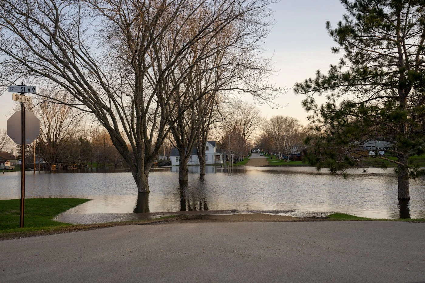
When the Town of Cicero declared a state of emergency on Beach Road this week, it wasn’t the first time. Beach Road floods. It has always flooded. The homes along Oneida Lake’s southern shoreline were built in a flood zone, and the lake’s water level is controlled by an agency in Albany that balances canal navigation and downstream flow, not Cicero’s property values.
New York’s Largest Inland Lake, Managed From 150 Miles Away
Oneida Lake is the largest lake entirely within New York State. That is not a debatable claim. It is a measured fact.
- Surface area: 51,072 acres (79.8 square miles)
- Dimensions: 20.9 miles long, 5.5 miles wide
- Shoreline: 54.7 miles
- Average depth: 22.3 feet
- Water volume: 370 billion gallons (at 367 ft elevation)
- Water residence time: 235 days, so it takes nearly eight months for water to cycle through
- Watershed: 872,722 acres across 69 municipalities in 6 counties (Oneida 34%, Madison 25%, Onondaga 16%, Oswego 14%, Lewis 10%, Cortland <1%)
- Population in watershed: approximately 262,164 residents
The New York State Canal Corporation, a subsidiary of the New York Power Authority, controls how water leaves the lake through the Caughdenoy Dam on the Oneida River. The dam feeds the Erie Canal/Barge Canal system. Water management decisions are made by the Canal Corp’s Syracuse Division based on system-wide navigation needs, not shoreline property protection.
This story came from public records we pulled ourselves
Get the next one, plus overnight incidents, in your inbox at 6 AM. Free, no spam.
The Dam Nobody’s Inspecting
The Caughdenoy Dam is the sole structure controlling water for a lake used by hundreds of thousands of people and surrounded by thousands of homes. Here’s what the National Inventory of Dams (NID ID: NY00410) says about it:
CAUGHDENOY DAM. SAFETY PROFILE
National Inventory of Dams · NID ID: NY00410 · Source: US Army Corps of Engineers
A 116-year-old dam controlling 255,360 acre-feet of water has not been inspected in 16 years and has no emergency action plan.
The dam is 15 feet high, holds back 255,360 acre-feet of storage, and drains a watershed of 1,382 square miles. It was built in 1909, improved in 1951, and the NYS DEC classifies its hazard potential as “Significant”. meaning failure could cause economic loss, environmental damage, or disruption of lifeline facilities. The dam’s inspection frequency is listed as 0 in the NID database.
The Flooding Pattern
Before the dam was built, Oneida Lake’s natural water level ranged from 370 to 373 feet above sea level. The Canal Corporation has narrowed that range to 368 to 371 feet. Maximum seasonal variation between their target minimum and maximum does not exceed nine inches.
But the targets are aspirational. When heavy spring rain meets Tug Hill snowmelt on a 1,382-square-mile watershed, the volume of water entering the lake outpaces what the single outlet can drain. All dam gates are fully open by December 1 and remain open through winter and spring. there’s no additional capacity to release water faster.
This year, Cicero Town Supervisor Rob Santucci banned all non-essential traffic on Beach Road through at least April 15. The Cicero Police Department is issuing citations to non-residents. Vehicle wakes from through-traffic were actively eroding properties and pushing floodwater against home foundations.
Sandbag stations at South Bay Fire Department and Muskrat Bay Fire Department were restocked with several thousand sandbags. Residents only.
Meanwhile, County Executive Ryan McMahon signed a separate emergency order on April 8 closing every waterway in Onondaga County, the first countywide waterway closure in approximately a decade.
CNY Is Getting Measurably Wetter
SYRACUSE ANNUAL PRECIPITATION (2011, 2023)
Source: NOAA / Current Results · 30-year normal: ~38.4 inches
Above 45″ (flood risk years)
Above 40″ normal
Below normal
New York State annual precipitation has been increasing at +0.47 inches per decade since 1901, a trend statistically significant at 99% confidence, per NOAA’s State Climate Summary. Syracuse recorded 49.6 inches in 2011, 47.9 inches in 2021, and 46.4 inches in 2019. all well above the approximately 38.4-inch normal.
March 2026 precipitation hit 5.58 inches at the Westmoreland station. 2.37 inches above normal, nearly double typical March rainfall. The pattern isn’t random. Of the last 13 years, 8 exceeded 40 inches of annual precipitation. More rain on a 1,382-square-mile watershed means more water entering a lake whose single outlet was built in 1909.
The Insurance Reality
Properties in FEMA-designated Special Flood Hazard Areas around Oneida Lake must carry flood insurance if they have a federally backed mortgage. Under FEMA’s Risk Rating 2.0 system (implemented April 2023), the average annual flood insurance premium in New York is $2,197, an 85% increase from pre-2021 rates.
Cicero is identified as a Repetitive Loss community in the 2025 Onondaga County Multi-Jurisdictional Hazard Mitigation Plan. meaning NFIP-insured structures have had 2+ paid flood claims where total payments exceed property value. The town has not joined the Community Rating System (CRS), which means residents miss out on the CRS premium discount that participating communities receive.
The Paradox: Values Keep Rising
Despite the flood risk, waterfront real estate keeps appreciating. The median sale price in Cicero over the last 12 months is $301,500, up 11% year-over-year. Zillow currently lists 28 Oneida Lake homes in the Town of Cicero. Across the entire lake, approximately 80 lakefront homes are on the market at any given time.
Shoreline development exploded in the 20th century: 476 dwellings in 1900 grew to 4,298 by 1960, a ninefold increase in 60 years. That building boom happened before flood maps, before Risk Rating 2.0, and before anyone was tracking whether Central New York’s springs were getting wetter.
THE ONEIDA LAKE ECONOMY
A lake that floods is also a lake that drives the regional economy
Cornell Biological Field Station at Oneida Lake has run the longest warmwater fishery assessment in New York State
Who’s Advocating for Homeowners?
The Oneida Lake Association, founded in 1945 with 2,500+ members, has been pushing for better coordination between the Canal Corporation’s water management and lakefront communities. Their position: draw down the lake earlier in fall to create capacity for spring runoff.
The Canal Corporation’s water management has an unintended ecological consequence the OLA has documented: by narrowing the lake’s natural range, spring flooding in critical wetland areas was eliminated. destroying spawning habitat for chain pickerel and northern pike. Photographic records from the early 1900s show dense emergent vegetation with 40+ shoreline plant species. By 1967, those stands were sparse. The dam management simultaneously fails to protect homes from flooding AND damages the fishery.
An Upstate Flood Mitigation Task Force, created by the NYS Legislature in 2017 and chaired by Canal Corp Director Brian U. Stratton, covers the Oswego River Basin (which includes Oneida Lake), nearly 8,500 square miles. The task force published findings in July 2023 after six years of work.
The Bottom Line
For Beach Road residents filling sandbags this week, the solution isn’t more sandbags. It’s a water management policy that accounts for the fact that CNY’s springs are getting wetter, the dam hasn’t been inspected in 16 years, there’s no emergency action plan, and the homes along Oneida Lake’s shoreline are the first to pay the price every spring.
The lake generates $50 million a year in fishing revenue and ranks first among New York’s inland waters. But the 4,298 homes built along its shoreline are living with a flood management system designed in 1909 and a dam inspection schedule that apparently doesn’t exist.
What to Know
- Caughdenoy Dam (NID: NY00410): built 1909, last inspected August 13, 2009, no emergency action plan, “Significant” hazard classification
- Average NY flood insurance: $2,197/year post-Risk Rating 2.0 (85% increase)
- Cicero: FEMA Repetitive Loss community, not in CRS discount program
- Home values: Cicero median $301,500 (+11% YoY) despite flood risk
- Development: 476 shoreline dwellings (1900) → 4,298 (1960)
- Precipitation trend: +0.47″/decade since 1901 (99% confidence, NOAA)
- March 2026: 5.58 inches, nearly double normal
- Economy: $50M+ annual fishing impact, #1 NY inland fishery, 850 miles of trout streams
- OLA: 2,500+ members since 1945, advocating for earlier fall drawdown
Sources: US Army Corps NID Database, CNY Regional Planning Board, NY Sea Grant/Oneida Lake Education Initiative, NOAA via Current Results, NOAA State Climate Summary, CNYWeather.com, NYS DEC Fisheries Report, Onondaga County 2025 Hazard Mitigation Plan, FEMA Risk Rating 2.0. Hero photo: none. CNY Signal does not publish stock photography on event-specific reporting, and no licensed image of the Beach Road flooding was available.
Why the watershed, not the lake, sets the water level
The figures in this article are usually quoted one at a time. Put them against each other and the Beach Road problem stops looking like a management failure and starts looking like a plumbing constraint.
Start with the ratio. The lake covers 51,072 acres. Its watershed covers 872,722 acres. The catchment is 17.1 times the surface it drains into, which means the lake level is set far more by what falls on six counties than by what falls on the water.
Now convert. An acre-foot is 325,851 gallons. One inch of rain across 872,722 acres is 72,727 acre-feet, or 23.7 billion gallons. Against a lake holding 370 billion gallons at 367 feet of elevation, a single inch of watershed rainfall is 6.4 percent of the entire lake, arriving over a day or two.
Apply that to March 2026, when Syracuse recorded 5.58 inches, close to double the monthly normal. Spread across the watershed that is roughly 132 billion gallons, or 35.7 percent of the lake’s volume, delivered inside 31 days.
The outflow side cannot keep pace with that, and the residence time says why. At 235 days for a full turnover, the lake moves about 1.57 billion gallons a day on average. One inch of watershed rain delivers roughly fifteen days of average outflow. Five and a half inches delivers about eighty four days of it. The Caughdenoy Dam is not withholding water out of indifference to Cicero. Over a wet month it is being handed more water than the Oneida River can carry away.
That is also the answer to why an earlier drawdown, the change the Oneida Lake Association has asked for since it organized in 1945, is the specific remedy residents keep raising. Storage bought before the rain arrives is the only lever that operates on this ratio. Once 23.7 billion gallons are in the system, the outlet is the bottleneck.
One more piece of arithmetic for the people who live with it. The shoreline runs 54.7 miles and the watershed holds about 262,164 residents, roughly 4,800 people upstream for every mile of shore. Shoreline dwellings went from 476 in 1900 to 4,298 in 1960, an increase of 803 percent, most of it built before the first federal flood maps existed. At a $2,197 average New York flood premium against Cicero’s $301,500 median home value, insuring against the water now costs about 0.73 percent of the house every year, and that is the post-Risk Rating 2.0 average rather than a shoreline-specific quote.
Sources & Verification
- US Army Corps of Engineers National Inventory of Dams, Caughdenoy Dam record, for the dam’s hazard classification and emergency action plan status.
- Central New York Regional Planning and Development Board and NY Sea Grant Oneida Lake Education Initiative, for surface area, dimensions, shoreline length, depth, volume, residence time, watershed acreage and watershed population.
- NOAA State Climate Summary for New York, for the precipitation trend of 0.47 inches per decade since 1901 at 99 percent confidence.
- FEMA Risk Rating 2.0 materials and the Onondaga County 2025 Hazard Mitigation Plan, for the flood insurance average and Cicero’s repetitive loss designation.
- NYSDEC Fisheries reporting for the fishery’s economic figures.
Original reporting in this piece: the watershed-to-lake ratio, the conversion of one inch of watershed rainfall into 23.7 billion gallons and 6.4 percent of lake volume, the March 2026 equivalent, the average daily outflow implied by the 235-day residence time, and the shoreline density and premium-to-value figures. All are CNY Signal calculations from the sourced figures above, using 325,851 gallons per acre-foot.
Correction, August 6, 2026. An earlier version of this article contained seven sentences broken mid-thought by an automated punctuation pass, including “The New York State Canal Corporation. a subsidiary of the New York Power Authority. controls how water leaves the lake.” Those sentences have been repaired. The article also credited its hero image to Pexels; CNY Signal does not publish stock photography on event-specific reporting and the credit has been withdrawn.
Reporting by CNY Signal. Published April 11, 2026. Corrected and expanded August 6, 2026.