Kimbillion Group proposes a 24,500 square foot assembly building on 3.5 acres off Interstate Island Road. The county attached one modification, and the state has already said no additional runoff may enter its drainage system.
There is a 3.5 acre vacant lot in the Town of Van Buren wedged between Interstate 690 and the New York State Thruway. A manufacturer wants to build on it, and the plans put the building partly on top of a drainage easement.
This story came from public records we pulled ourselves
Get the next one, plus overnight incidents, in your inbox at 6 AM. Free, no spam.
The Onondaga County Planning Board reviewed the site plan on August 5 as case Z-26-185, with a companion area variance referral filed as Z-26-186. The applicant is Kimbillion Group, Inc. The referring board for the site plan is the Town of Van Buren Planning Board, and for the variance it is the town’s zoning board.
The proposal is a 24,500 square foot building for the assembly of wood product panels, at 7055 Interstate Island Road, on a parcel zoned Industrial A.
The coverage math
The variance request is the clearest number in the file. The applicant asks to allow 60 percent lot coverage where town code sets 50 percent as the maximum.
The environmental assessment form dated June 29, 2026 supports that request with its own figures: 2.55 acres of the 3.5 acre site would be disturbed, resulting in 2.14 acres of impervious surface.
Run that against the parcel and 2.14 acres of 3.5 is about 61 percent. The variance is not a rounding request. It is the difference between what the code allows and what this building plus its asphalt actually needs.
Per the site plan dated June 30, 2026, the building sits in the middle of the site, surrounded by asphalt on all sides, with a 17 space parking lot along the road frontage and a gravel storage yard behind the rear asphalt.
Seventeen parking spaces for a 24,500 square foot assembly building is worth noting on its own. This is a manufacturing use, not a retail one, and the parking count reflects a shift-based workforce rather than customer traffic.
The easements the building would cross
This is the part that will need working out before anything gets built.
A topographic survey dated July 31, 2017 shows three drainage easements on the parcel, each 20 feet wide. One runs along the rear, northern boundary. One runs along the eastern boundary. And one crosses the site north to south, through the middle.
There is also a 150 foot wide Niagara Mohawk Power Corporation easement along the rear parcel boundary.
County staff then state the consequence directly. The building, asphalt and gravel storage area will encroach on the 20 foot wide drainage easement crossing the site. And a portion of the rear asphalt, the gravel storage area and the rear stormwater basin will occur within the Niagara Mohawk easement.
An easement is a right someone else holds over land you own. A drainage easement generally exists so water can move through and so whoever maintains that drainage can get to it. A utility easement of that width usually exists for transmission infrastructure and the access needed to service it.
Building over either one is not automatically prohibited, but it is not the applicant’s decision alone. The easement holder has to agree, and what gets built inside the easement is usually limited to things that can be removed or worked around.
That question is not resolved in the materials the county reviewed.
The state’s answer on stormwater
The county recommended one modification, and it comes from the New York State Department of Transportation.
Additional stormwater runoff into the state’s right of way is prohibited, and no direct connection into the state stormwater system is permitted. The applicant must contact the department for further information.
That is a hard boundary rather than a negotiation. The site abuts Interstate 690 to the north and sits across from the Thruway to the south, so it is surrounded by state right of way holding state drainage infrastructure. The plan adds 2.14 acres of impervious surface, and impervious surface is what generates runoff.
Per the site plan, stormwater basins would sit along the western and northern parcel boundaries. The northern boundary is also where the rear easements are, and where the abutting interstate is. Fitting basins sized for two acres of new pavement into that corner, without sending anything into the state system, is the engineering problem this project has to solve.
Because the site disturbs more than one acre, it also needs coverage under the state SPDES stormwater permit before the town approves anything.

Water, sewer and what is underneath
A new connection to public drinking water is proposed. The assessment form anticipates the site using 600 gallons of drinking water per day, which is a modest industrial demand and consistent with an assembly operation rather than a process that consumes water.
The county water authority’s engineering department has to be contacted to determine water availability and service options, obtain hydrant flow test information, evaluate backflow prevention requirements and assess fire flow availability. Fire flow matters here: a 24,500 square foot building holding wood panels is a significant fire load, and available flow determines what the building’s protection system can be designed around.
A new sewer connection is also proposed. The site sits in the Baldwinsville-Seneca Knolls Wastewater Treatment Plant and Interstate Pump Station service areas. The county requires capacity assurance because the use is changing, with the standard rule that flows exceeding prior use by more than one sewer unit trigger a one gallon to one gallon offset plan developed with the municipal engineer.
Two environmental notes carry forward. The site sits over, or immediately adjoining, primary and principal aquifers. And it may contain the Indiana bat or its habitat, a species listed as threatened or endangered, with county staff noting that impacts to bats are often tied to tree clearing and that aerial imagery suggests trees would be removed.
What is already on this road
The surrounding uses tell you what kind of corridor this is.
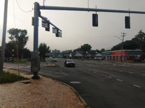
County staff list an RV retailer, a commercial truck service company, a moving and storage company, and a control panel manufacturer nearby. Interstate Island Road runs between I-690 to the north and the Thruway to the south, with John Glenn Boulevard to the east.
This is an industrial pocket that exists because of the highways around it. A wood panel assembly plant fits the neighborhood, and nothing in the county file suggests the use is in question. What is in question is whether it fits this particular 3.5 acres at the size proposed.
What Industrial A zoning is for
The parcel is zoned Industrial A, and coverage limits in industrial districts exist for reasons that are easy to miss.
A lot coverage cap is not an aesthetic rule. It is a stormwater rule wearing a zoning label. Every square foot of roof, asphalt and compacted gravel is a square foot where rain that used to soak in now runs off instead. Cap coverage at 50 percent and roughly half the parcel remains available to absorb water. Push it to 60 and that reserve shrinks by a fifth.
That is why the coverage variance and the stormwater modification are the same issue viewed from two angles. The applicant wants more hard surface. The state has said the extra water cannot leave the property into its system. The land in between has to absorb the difference, and the variance reduces how much land is left to do it.
A zoning board weighing this is entitled to ask how those two facts resolve, because the answer determines whether the site works in a heavy rain rather than on paper.
Why the county saw it at all
Interstate Island Road is a local road. The Town of Van Buren could ordinarily handle a site plan on a local road by itself.
County jurisdiction attached here because the site lies within 500 feet of Interstate 690 and the New York State Thruway, both state roads. Under General Municipal Law Section 239-m, that proximity pulls the application into county review, which is also how NYSDOT’s position ended up in the file as a formal condition rather than an informal conversation.
That is a small illustration of why the referral system exists. A town reviewing this alone might reasonably have focused on the building, the parking and the setbacks. The referral is what put the interstate drainage system, the aquifer beneath the site and a listed bat species into the same document.
The wider Van Buren picture
This is not the only significant proposal in Van Buren this season.
CNY Signal has reported on a separate application to rezone 103 acres on Crego Road for roughly 304 housing units, where the town board declared itself lead agency under state environmental review. The county also reviewed another Van Buren site plan on Crego Road at its August 5 meeting.
Those are residential and this is industrial, and they are unrelated projects. But together they describe a town absorbing several kinds of growth in the same year, each with its own drainage, traffic and utility demands landing on the same municipal staff.
For residents, the practical way to track it is the town’s own agendas. The planning board and zoning board of appeals both post them, and both bodies will handle a piece of this particular application.
The two decisions, and what happens next
On the site plan, case Z-26-185, the board recommended a modification: the NYSDOT stormwater requirement described above.
On the area variance, case Z-26-186, the board determined the referral will have no significant adverse inter-community or county-wide implications and offered the same NYSDOT requirement as a comment rather than a modification.
That difference matters procedurally. A modification raises the voting threshold for a local board that wants to approve anyway. A comment does not. The county attached the stronger version to the site plan, which is the approval that actually authorizes construction.
Both decisions now sit with the Town of Van Buren. The planning board handles the site plan. The zoning board of appeals handles the variance, and a variance is decided on statutory criteria including whether the benefit to the applicant outweighs detriment to the neighborhood and whether the difficulty is self-created.
For anyone following this one, the questions worth asking are concrete. Whether the drainage easement holder has agreed to structures over the easement crossing the site. Whether Niagara Mohawk has agreed to pavement, storage and a stormwater basin inside a 150 foot transmission easement. And how two acres of new pavement drain on a parcel where the state has already said its own system is off limits.
The county’s August 5 minutes, including both resolutions and the full staff report described here, are posted by the Onondaga County Department of Planning.