SAIA Motor Freight wants its DeWitt property recorded as a single 5.74 acre parcel. The paperwork is routine. What the survey shows underneath it is not: a 300 foot Niagara Mohawk easement crossing the site, with a town water line inside it.
This is a subdivision application that does not subdivide anything. It merges.
This story came from public records we pulled ourselves
Get the next one, plus overnight incidents, in your inbox at 6 AM. Free, no spam.
SAIA Motor Freight Line proposes to combine the three parcels that make up its property at 147 Falso Drive in the Town of DeWitt into a single lot of 5.74 acres, to be recorded as Lot No. 1. The Onondaga County Planning Board reviewed it on August 5 as case S-26-23. The referring board is the Town of DeWitt Planning Board.
The board found no significant adverse inter-community or county-wide implications and sent it back to the town to act on alone. On the merits of the merger, that is the right call.
But the survey filed with it describes a site that is more constrained than a trucking terminal usually is, and those constraints are worth reading.
Why merge lots at all
Combining parcels under common ownership is one of the most common and least dramatic things that happens in a planning office. It is also genuinely useful, and the reasons are practical.
A building that straddles a property line is a problem. Setbacks are measured from lot lines, so an interior line running through a developed site can make existing structures technically nonconforming, complicate any future addition, and turn a routine building permit into a variance application.
Merging also simplifies taxation, title, insurance and financing. One parcel, one assessment, one description.
For an operating freight terminal that has grown across three lots over time, consolidating to one is housekeeping that makes everything afterward easier.
Per the Final Plan SAIA Property, dated May 26, 2026, that is exactly what is proposed. Three parcels become Lot No. 1, at 5.74 acres.
What is on the ground now
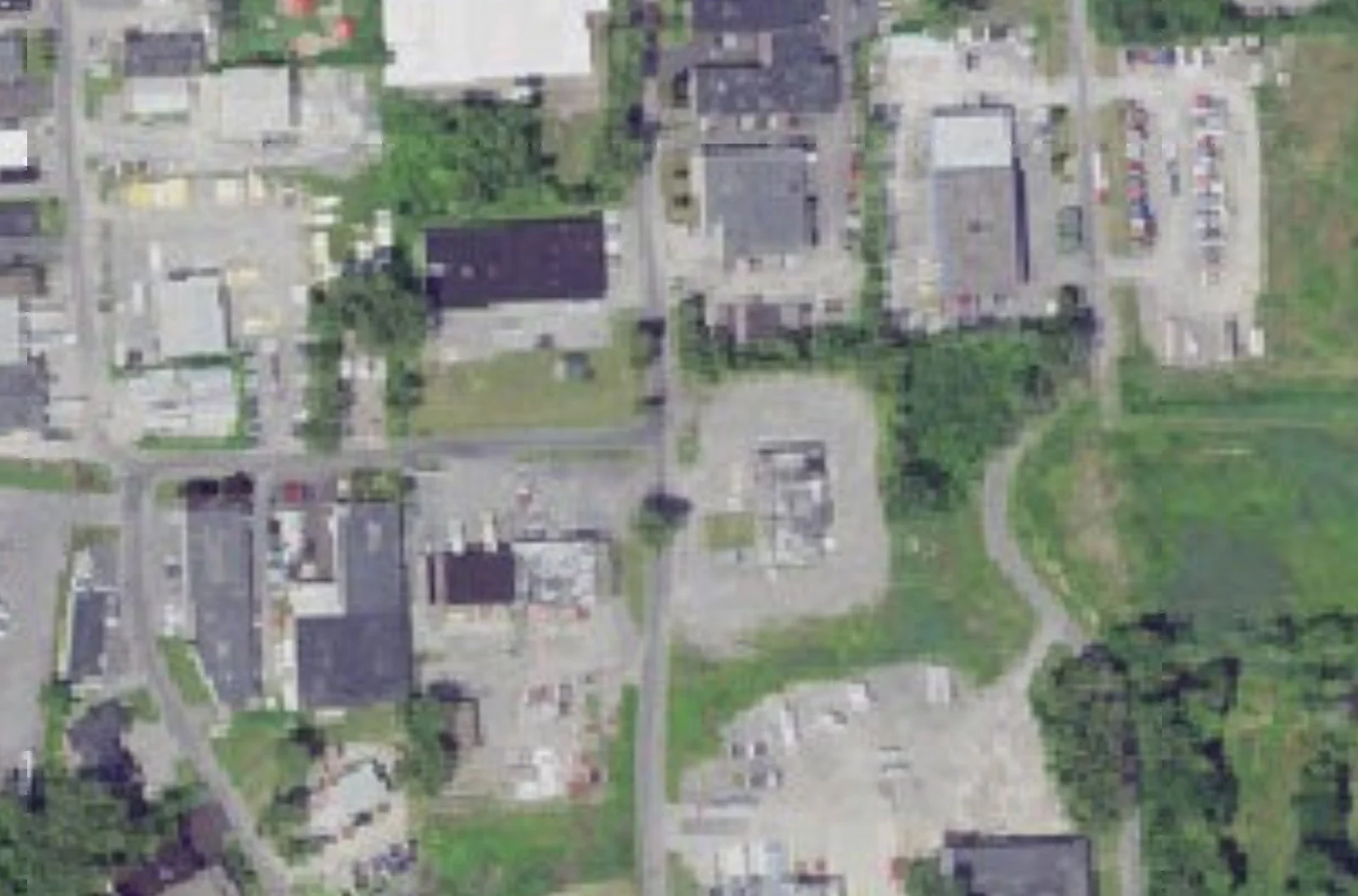
County staff describe an existing building of roughly 14,900 square feet, surrounded by asphalt. Per aerial imagery from May 2024, loading truck bays sit on both sides of the building.
The area north and east of the building appears to contain gravel or broken asphalt, used for parking and storage. The northern portion of the eastern parcel appears to be wooded.
Access comes from two driveways onto Falso Drive and one onto Moore Road, both local roads. No changes to access are proposed.
Loading bays on both sides of a building is the detail that tells you what this operation is. A less-than-truckload freight terminal is a cross-dock: freight comes in one side, gets sorted, and goes out the other. The building is not storage. It is a sorting floor with doors.
The corridor overhead
Here is the part that makes this site unusual.
Per the subdivision plan, a Niagara Mohawk Power Corporation easement 300 feet wide, containing overhead electrical wires, crosses the site north of the existing building.
Three hundred feet is a transmission corridor, not a distribution line. That is the scale of easement associated with high-voltage lines on lattice towers, and it typically prohibits permanent structures entirely, restricts what can be parked or stored beneath it, and requires access for maintenance equipment.
And inside that easement sits another one: a 20 foot wide Town of DeWitt right-of-way easement containing an 8 inch water line.
So the northern portion of this newly merged 5.74 acre parcel carries a utility corridor within which the town also holds a right-of-way for a water main. Whatever the deed says about ownership, the usable area is smaller than the acreage suggests.
That is not a defect in the application. It is a description of the land, and it is precisely why the merger is worth doing: recording one parcel makes the encumbrances legible in one place rather than spread across three descriptions.

The county has raised this before
The staff report notes one prior review, and its advice is directly relevant.
Earlier this year, site plan referral Z-26-30 covered improvements to the existing distribution facility, including a partial demolition, construction of a new loading dock, relocating the dumpster enclosure, and improvements to ADA access, sidewalks, stairs and parking.
On that application, the board encouraged the town and the applicant to ensure appropriate approvals are in place for any parking or construction of permanent structures within the National Grid powerline corridor easement.
That is the same corridor. The county flagged it when the company proposed building, and the merger now records it formally on a single plat.
The sequence is a small demonstration of why county referrals are useful. An issue raised on one application shows up documented on the next, and the town has a paper trail rather than an institutional memory.
The neighborhood is trucks
County staff place the site in an area characterized by commercial uses and distribution warehouses, north of the New York State Thruway, south of East Molloy Road, and west of Townline Road.
The named neighbors are a good description of the district: V Line Inc Trucking and Warehousing, Rick’s Wheels, Bluefors Cryocooler Technologies Inc, and DeWitt Auto Clinic.
Three of those four are vehicles or freight. The fourth makes cryogenic cooling systems, which is the kind of business that has quietly moved into Central New York industrial parks over the past decade.
This is not a corridor where a freight terminal is out of place. It is a corridor built for them, positioned between the Thruway and the airport.
What less-than-truckload actually means
SAIA is a less-than-truckload carrier, and the business model explains why its terminals look the way they do.
A full truckload carrier picks up one shipment, drives it to one destination, and unloads. Less-than-truckload consolidates many smaller shipments from many customers into shared trailers. A pallet from one business rides alongside pallets from a dozen others.
That only works with a network of terminals where trailers are unloaded, freight is re-sorted by destination, and new trailers are loaded. The terminal is a hub in that network, and it is measured by how many doors it has and how fast freight moves across the floor, not by how much it can hold.
That is why the building here is modest at roughly 14,900 square feet while the yard around it is large and paved. Freight barely stops. Trailers do.
It also explains why a site like this generates truck traffic concentrated in specific windows. LTL terminals typically run inbound overnight and outbound in the morning, so the neighbors experience it as a pattern rather than a constant.
The value of getting encumbrances onto one plat
There is a quiet argument for applications like this that rarely gets made, and it is about public records.
Right now the constraints on this property are described across three separate parcel descriptions, an easement granted to a utility, and a town right-of-way. Anyone trying to understand what can be done on that ground has to assemble the picture from several documents.
After the merger, one filed plat shows the whole thing: the boundary, the transmission corridor, the water line right-of-way, the building.
That is worth something to future buyers, to the town’s own codes office, to the utility, and to anyone researching the site years from now. Records that are scattered get misread. Records that are consolidated get followed.
For a town, encouraging property owners to clean up fragmented parcels is one of the cheapest forms of long-term administrative hygiene available.
The one thing worth confirming
Nothing in this application is objectionable, but there is a single item a planning board should confirm rather than assume.
The 2026 improvements referral, Z-26-30, involved a new loading dock, a relocated dumpster enclosure and parking work. The county’s advice then was to ensure approvals were in place for any parking or permanent structures within the powerline corridor easement.
That advice was given. Whether it was followed is not recorded in the merger file, because a lot merger does not review construction.
Since the merger is the moment the corridor gets formally drawn onto a single plat, it is also the natural moment to check that what has already been built and paved near it was approved by the easement holder.
The scale of the actual work
The environmental assessment form, dated July 20, 2026, puts disturbance at 0.12 acres.
That is roughly 5,200 square feet on a 5.74 acre site, or about two percent. A lot merger with almost no ground disturbance is about as low-impact as a land use application gets, which is why the county cleared it without conditions.
The vote was recorded as Marty Voss yes, Michael LaFlair yes, Marty Masterpole yes, Craig Dennis yes, Renee Dellas yes, Don Radke yes and Kevin Casserino yes. The motion was made by Don Radke and seconded by Michael LaFlair.
What to watch
The decision belongs to the Town of DeWitt Planning Board, and this one is very likely to be approved.
The useful thing for a resident is not to object. It is to note what the record now establishes. After this merger, the town has a single filed plat showing a 300 foot transmission easement and a town water right-of-way across a working freight terminal.
That document governs what can be built there for as long as the property exists. Any future expansion at 147 Falso Drive gets measured against it, and anyone who wants to know what is under that yard now has one place to look.
The county’s August 5 minutes, including the resolution, the recorded vote and the full staff report described here, are posted by the Onondaga County Department of Planning. The Town of DeWitt posts planning board agendas and minutes on the town website.