The Gas Line Feeding Micron Runs Past Clay Town Hall. The Filing Lists 1.4 Acres of Permanent State Wetland Impact
National Grid wants to expand a regulator station on Route 31 and build a metering station on the Micron campus, fed by a 16 inch main. County planners cleared it July 15. The stormwater plan was submitted to the town but not included in what the county reviewed.
Micron needs gas. The paperwork showing how it gets there came before the Onondaga County Planning Board on July 15, and it is more revealing than most utility filings.
This story came from public records we pulled ourselves
Get the next one, plus overnight incidents, in your inbox at 6 AM. Free, no spam.
The case is Z-26-175. The applicant is listed as National Grid and Micron. The referring board is the Town of Clay Planning Board. It covers two locations at once: 4459 State Route 31 and 8720 Caughdenoy Road, tax parcels 029.-01-13.1 and 048.-01-01.0.
The proposal is to expand an existing National Grid regulator station on Route 31, build a new natural gas metering station on the Micron campus off Caughdenoy Road, and run a new service line between them. The parcels sit in Government and Industrial 2 zoning districts.
The county determined the referral will have no significant adverse inter-community or county-wide implications and may be acted on solely by the referring board. The motion came from Don Radke, seconded by Renee Dellas, with Marty Voss, Michael LaFlair, Renee Dellas and Don Radke recorded yes.
The wetland numbers in the file are the part worth reading closely.
### Two sites, one system
The Route 31 end is small and hemmed in. It is a 0.61 acre parcel holding an existing National Grid regulator station, described in the staff report as a gravel area containing gas infrastructure surrounded by fencing.
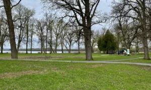
What surrounds it is the notable part. The parcel is bounded by Town of Clay property on three sides: Town Hall to the west, the Clay Department of Public Works complex to the east, and Clay Park to the north at the rear.
Per the overall station plan dated June 30, 2026, the work there is installing additional equipment and gas mains inside the existing parcel. The existing fence comes out and a new eight foot fence goes up around an expanded gravel area.
The Caughdenoy Road end is inside the Micron campus itself. That is a 99.05 acre parcel, part of a contiguous area bounded by Route 31, Caughdenoy Road and Burnet Road. The work sits in the northwest corner, adjacent to Caughdenoy Road, immediately south of where Caughdenoy Road meets railroad tracks belonging to NY Central Lines.
Per the site plan dated June 19, 2026, that end gets a Micron Gas Metering Station, referred to in the filing as a GLM. It would be a fenced gravel area holding concrete pads and gas infrastructure. A 16 inch gas main enters the area from the south along the Caughdenoy Road frontage.
### The wetland impacts, quoted in full
Most site plan filings summarize wetland effects loosely. This one gives a line-item accounting, and the county reproduced it from the environmental assessment form’s supplemental responses.
The permanent impacts listed are 0.087 acres of federally regulated wetlands and 1.354 acres of state regulated freshwater wetlands. On top of that, 0.027 acres of federally regulated forested wetland conversion and 1.586 acres of forested conversion in state regulated adjacent area. Plus 175 linear feet of federally regulated stream impacts, affecting 1,050 square feet.
The temporary impacts are larger. The filing lists 7.029 acres of federally regulated wetlands, 5.359 acres of state regulated freshwater wetlands and 4.784 acres of state regulated adjacent area.
Add the permanent state and federal wetland figures together and the project permanently affects roughly 1.44 acres of regulated wetland, with about another 1.6 acres of forested area converted. The temporary disturbance touches more than 17 acres of regulated wetland and adjacent area.
Temporary is a real category, not a loophole. It means the ground gets opened to lay pipe and then restored. But restoration of a forested wetland is not the same as never having cleared it, which is why the state and federal permit programs treat conversion separately from disturbance.
### What the county did not receive
Two gaps in the filing are stated plainly in the staff report.
The first is on stormwater. Per the environmental assessment form dated June 26, 2026, 6.5 acres of the site will be disturbed, and a Stormwater Pollution Prevention Plan was prepared and submitted to the town with the application.
Then: the SWPPP was not included with the referral materials.
So the county reviewed a project disturbing 6.5 acres without the stormwater document in hand. The town has it. The county did not.
The second gap is on the Route 31 wetlands. The overall station plan shows existing wetlands adjacent to the western site boundary and on site along the northern and eastern boundaries. The staff report adds that wetland delineation information is not provided.
At the Caughdenoy Road end the picture is different. GIS mapping shows the parcel may contain state and federal wetlands along its southern and eastern boundaries, but the subject area does not appear to encroach on them, and no wetlands are depicted on the plans for that location.
The standing advisory applies to both: wetland regulations require permits from the state Department of Environmental Conservation and the U.S. Army Corps of Engineers for development in, fill placed in, or drainage of a state or federal wetland or a 100 foot state wetland buffer.
### Access and easements
The Route 31 site keeps its existing driveway to the state highway with no changes proposed.
The Caughdenoy Road site gets a 22 foot wide driveway to reach the metering station, plus a 16 foot wide temporary construction entrance on the northern portion of the road frontage.
Two highway advisories attach, one per jurisdiction. All driveways on Route 31 must meet New York State Department of Transportation requirements. All driveways on Caughdenoy Road, which carries Route 49 and is a county highway, must meet Onondaga County Department of Transportation requirements.
On easements, the referral notice states that the gas line will run underground through existing National Grid easements. At the Route 31 end, an easement plan dated December 10, 2020 shows a 20 foot wide easement to Niagara Mohawk Power Corporation surrounding the National Grid parcel, and a topographic map dated May 23, 2019 shows existing sanitary sewer infrastructure along the Route 31 frontage. At the Caughdenoy end, the metering station and gas main sit within a permanent easement.
County Water Environment Protection adds its standard condition: no permanent structures are permitted within the county easement, and any other work inside it must be coordinated with the department.
Neither site has existing public drinking water or wastewater service, and no changes to that are proposed. These are unstaffed utility installations, not buildings people occupy.
### The Micron file, so far
The staff report lists the county’s prior reviews tied to the Micron project, and together they sketch the scale of what is being assembled in Clay.
There was a site plan referral, Z-25-290, and an area variance, Z-25-291, for the manufacturing facility itself. There were a site plan, Z-25-292, and area variances, Z-25-293, for an associated rail spur across Caughdenoy Road from the Micron site.
There were subdivision referrals: S-25-42, combining 34 parcels into one new 819 acre lot for the lands within the Town of Clay, and S-26-5, adding further lands within the Town of Cicero to the site.
And there were two local laws plus a zone change tied to the White Pine Commerce Park, filed as Z-24-258, Z-25-50 and Z-23-158.
Thirty-four parcels became one 819 acre lot. A rail spur. A manufacturing facility. Now the gas that feeds it.
### Why this filing is worth keeping
Utility infrastructure is the least covered part of a project like Micron, and it is where a lot of the environmental effect actually lands. A factory sits on a footprint. The lines that serve it cross whatever is between the source and the site.
That is visible in the numbers here. The buildings in this application are two fenced gravel pads. The wetland impact accounting runs to seven separate figures.
It is also visible in the geography. The Route 31 regulator station being expanded sits between Clay Town Hall and the town DPW complex, with a town park behind it. That is municipal land on three sides of a growing gas facility, which is a fact residents of Clay may not know and can verify from the county’s own staff report.
The decision belongs to the Town of Clay Planning Board. The county’s July 15 minutes, including the resolution, the recorded vote and the full staff report quoted here, are posted by the Onondaga County Department of Planning.
Two things are worth checking later rather than arguing about now. Whether the state and federal permits for those wetland impacts are issued as described. And whether the stormwater plan the county never saw holds up for 6.5 acres of disturbance next to a park.